In case anyone has been hiding in a cave and missed all the severe weather talk and forecasting, here's a head's up!
Severe Weather, including strong winds, large and damaging hail and tornadoes are possible in many parts of the state today and in adjacent areas. In fact, today's Severe Weather will extend very far north and even Iowa has a high tornado potential today.
Meanwhile, at the southwestern end of the state, a Red Flag Fire Warning is in effect this afternoon and evening where high temperatures are expected to easily exceed 100 degrees, gusty winds will be blowing and the relative humidity is forecast to bottom out in the single digits in some areas.
For those of you who follow Dr. Greg Forbes and his TorCon forecast, when I checked it this morning, he has a 7 on Central and Northeastern OK. On a scale that tops out at 10, a seven is fairly serious.
The NWS in both Tulsa and Norman have fantastic graphics and info on their websites and I encourage everyone to visit the website of their weather forecast office for the most current information.
For anyone fairly new to OK and/or severe weather, keep in mind that tornadoes can form without warning when the conditions are right so you need to be aware of your surroundings at all times. They also can form in areas near Tornado Watch areas but which do not have a Tornado Watch, so don't feel like you're 100% safe if the Severe Thunderstorm Watch or Tornado Watch area is near you but doesn't include your county. That does not mean you're out of the woods. When you have a watch or warning near you, you should know that similar conditions possibly could affect you even if you are outside the watch or warning area.
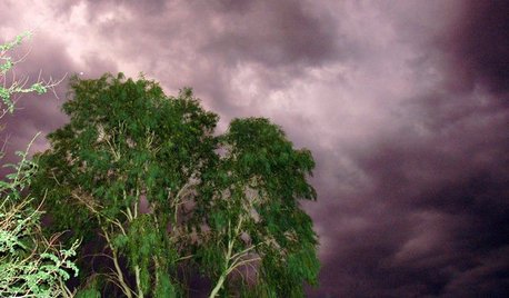
It is nice when the NWS is able to warn us and when local TV stations can provide practically street by street warnings in real time, but we all need to remember that if a tornado forms suddenly right over your head or very close to you, the NWS and media warnings that follow won't be early enough for you. Keep an eye on your skies.
Today the storm initiation could begin as early as 2 pm if the conditions come together that early so be prepared for an earlier start than we saw yesterday.
If strong hail, high winds or a tornado threaten your area, remember to seek shelter in an interior room or closet on the lowest floor of your home, preferably in a room with no windows. In the absence of a tornado shelter or a concrete and steel safe room, they are your safest location. It is never recommended that you get into your car and try to outrun a storm.
I'm going to link the SPC's Convective Outlook for today before I head out. I'll be back in around noon to monitor for the issuance of a Severe Thunderstorm Watch or Tornado Watch, but if one of y'all see something like that first, please post it on this forum!
We have some forum members who are in remote areas or where they are low in valleys and their reception of media information or weather radio alerts can be blocked by the surrounding land that is of a higher elevation, so for some people, this forum often gives them their first alert that a storm is developing in their area.
If you have smart phones, many weather apps are available that will send storm warnings right to you once they are issued.
Be sure the alert feature on your All Hazards/Weather Radio is "on". If your area loses power and if cell towers are damaged and you are cut off from communication with the rest of the world, remember that text messages often get through even when you cannot make phone calls.
Stay safe everyone. Today's weather has the potential to be seriously bad.
Finally, I listened to Dr. Forbes on TWC earlier and he mentioned that storms may start firing up near OKC and then move towards Tulsa, so I think that for all of us, that was a great clue about what to expect.
When you click on the link to read the convective outlook, you can see the risk areas highlighted in different colors. If you want to see the specific risk areas for tornadoes, hail or wind, click on the black boxes near the top of the page that contain those words and you can see what your specific risk of each of those is for your area.
Dawn
Here is a link that might be useful: SPC's Convective Outlook Day 1


ReedBaize
wulfletons
Related Professionals
Burlington Landscape Contractors · Clayton Landscape Contractors · Glendale Heights Landscape Contractors · Kearny Landscape Contractors · Parker Landscape Contractors · Ridgewood Landscape Contractors · Silver Firs Landscape Contractors · Hueytown Landscape Contractors · Crestline Decks, Patios & Outdoor Enclosures · Hot Springs Village Decks, Patios & Outdoor Enclosures · St. Louis Decks, Patios & Outdoor Enclosures · Sun Lakes Decks, Patios & Outdoor Enclosures · Verona Decks, Patios & Outdoor Enclosures · Westford Decks, Patios & Outdoor Enclosures · Truckee Decks, Patios & Outdoor EnclosuresReedBaize
Okiedawn OK Zone 7Original Author
Okiedawn OK Zone 7Original Author
Okiedawn OK Zone 7Original Author