


5-24: TorCon Index Raised to 9 for NC, 7 for SC
Okiedawn OK Zone 7
12 years ago
Related Stories
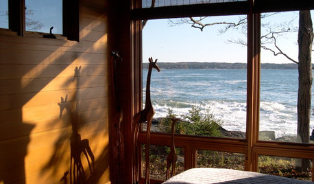
BEDROOMS9 Beautiful Bedroom Views Shared by Houzzers
See great vistas throughout the U.S. and Canada, with stories and details from the homeowners
Full Story
GARDENING GUIDES5 Best-Behaved Trees to Grace a Patio
Big enough for shade but small enough for easy care, these amiable trees mind their manners in a modest outdoor space
Full Story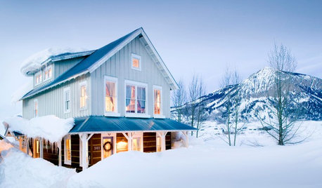
LIFEHard Winter? 9 Ways to Battle Cabin Fever
We know a lot of you are trapped where it just won’t stop snowing. Here are some ways to survive
Full Story
HOUZZ CALLHouzz Call: Show Us Your 8-by-5-Foot Bathroom Remodel
Got a standard-size bathroom you recently fixed up? We want to see it!
Full Story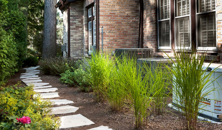
MOST POPULAR5 Ways to Hide That Big Air Conditioner in Your Yard
Don’t sweat that boxy A/C unit. Here’s how to place it out of sight and out of mind
Full Story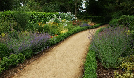
LANDSCAPE DESIGN5 Gravel and Stone Types for a Rockin' Landscape
Give your garden design some textural bam with pebbles, granite, river rocks and other permeable materials
Full Story
FUN HOUZZEverything I Need to Know About Decorating I Learned from Downton Abbey
Mind your manors with these 10 decorating tips from the PBS series, returning on January 5
Full Story
Gift Guide: 50 Flat or Foldable Finds
Make shipping extra easy this holiday with gifts you can send in a flat-rate envelope
Full Story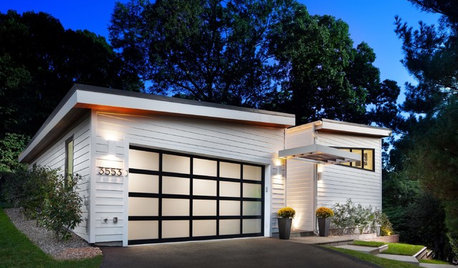
GARAGESKey Measurements for the Perfect Garage
Get the dimensions that will let you fit one or more cars in your garage, plus storage and other needs
Full Story
GARDENING FOR BUTTERFLIESBe a Butterfly Savior — Garden for the Monarchs
Keep hope, beauty and kindness alive in the landscape by providing a refuge for these threatened enchanters
Full Story
Related Professionals
Forest Acres Landscape Architects & Landscape Designers · Montgomeryville Landscape Architects & Landscape Designers · Roxbury Crossing Landscape Architects & Landscape Designers · Brooklyn Center Landscape Architects & Landscape Designers · White Oak Landscape Architects & Landscape Designers · Americus Landscape Contractors · Framingham Landscape Contractors · Secaucus Landscape Contractors · Teaneck Landscape Contractors · Maplewood Landscape Contractors · Palos Heights Landscape Contractors · Bethany Decks, Patios & Outdoor Enclosures · Estero Decks, Patios & Outdoor Enclosures · Salisbury Decks, Patios & Outdoor Enclosures · Watauga Decks, Patios & Outdoor Enclosures