


If your a weather watcher-next week could get interesting
jimhardy
11 years ago
Sort by:Oldest
Comments (28)
Related Stories

BASEMENTSBasement of the Week: Guests Get a Cottage-Like Stay
Converted to a comfy space with a full bath, a bedroom and extra amenities, this Maryland basement is great for visitors and the owner alike
Full Story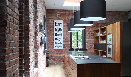
KITCHEN DESIGNKitchen of the Week: A Onetime Carnegie Library Gets Cooking
Trading books for baguettes, this California kitchen underwent years of remodels before its latest modern incarnation
Full Story
KITCHEN DESIGNKitchen of the Week: Grandma's Kitchen Gets a Modern Twist
Colorful, modern styling replaces old linoleum and an inefficient layout in this architect's inherited house in Washington, D.C.
Full Story
KITCHEN OF THE WEEKKitchen of the Week: A Classic Craftsman Gets a Colorful Twist
A key bump-out in the back and bold walls give a Seattle family’s galley kitchen better flow and a warm feel
Full Story
DINING ROOMSNew This Week: Proof the Formal Dining Room Isn’t Dead
Could graphic wallpaper, herringbone-patterned floors, wine cellars and fire features save formal dining rooms from extinction?
Full Story
DECORATING GUIDESColor of the Week: Decorating With Warm Gray
Tired of tan? Getting gloomy from cool gray? Make warm gray your new go-to neutral
Full Story
EVENTS5 Big Trends From This Week’s High Point Market
Learn the colors, textures and shapes that are creating a buzz in interior design at the market right now
Full Story
LIVING ROOMSNew This Week: 5 Living Rooms Designed Around the Fireplace
Overcome one of design’s top obstacles with tips and tricks from these living rooms uploaded recently to Houzz
Full Story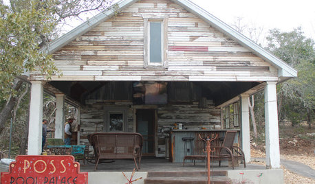
POOL HOUSESNew Pool House Comes by Its Weathered Look Naturally
The Texas Hill Country structure is made from materials salvaged from a dilapidated sharecropper's house and an old barn
Full Story
HOUSEKEEPING7-Day Plan: Get a Spotless, Beautifully Organized Entry Hall
Take your entry from scuffed up to spiffed up — restoring total cleanliness and order in just a week
Full StorySponsored
More Discussions


islandbreeze
chadec
Related Professionals
Benbrook Landscape Architects & Landscape Designers · Salem Landscape Architects & Landscape Designers · Vernon Hills Landscape Architects & Landscape Designers · Wilmington Landscape Contractors · Addison Landscape Contractors · Beverly Hills Landscape Contractors · Fort Atkinson Landscape Contractors · Kaneohe Landscape Contractors · Long Beach Landscape Contractors · Mercedes Landscape Contractors · East Norriton Landscape Contractors · Lees Summit Window Contractors · San Antonio Window Contractors · Atlantic Beach Window Contractors · Marinette Window Contractorstropicalzone7
miketropic
tropicbreezent
islandbreeze
jimhardyOriginal Author
User
miketropic
jimhardyOriginal Author
tropicalzone7
jimhardyOriginal Author
miketropic
neonrider
miketropic
jimhardyOriginal Author
miketropic
islandbreeze
miketropic
LagoMar
williamr
miketropic
LagoMar
User
statenislandpalm7a
LagoMar
User
prinbama