


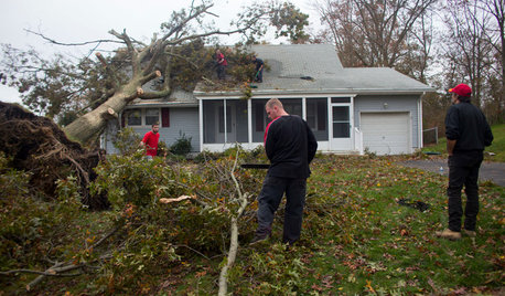
Hurricane Irene Reports / Damage / Photos
NoVaPlantGuy_Z7b_8a
12 years ago

Related Stories
MOST POPULARWhat to Do After a Hurricane or Flood
How you treat your home after a natural disaster can make all the difference in its future livability — and your own personal safety
Full Story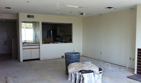
DISASTER PREP & RECOVERYRemodeling After Water Damage: Tips From a Homeowner Who Did It
Learn the crucial steps and coping mechanisms that can help when flooding strikes your home
Full Story
ARCHITECTURE4 Things a Hurricane Teaches You About Good Design
When the power goes out, a home's design can be as important as packaged food and a hand-crank radio. See how from a firsthand account
Full Story
LIFEHouzz Call: Who'll Post the First Snow Photo of 2013?
If the weather's been flaky in your neck of the woods, please show us — and share how you stay warm at home
Full Story
KITCHEN OF THE WEEKKitchen of the Week: The Calm After the Storm
Ravaged by Hurricane Sandy, a suburban New York kitchen is reborn as a light-filled space with a serene, soothing palette
Full Story
DISASTER PREP & RECOVERYFamily’s New Style Rises in the Aftermath of a Flood
After their damaged walls are demolished, homeowners realize they like the open space and decide to keep it
Full Story
HOUZZ TOURSMy Houzz: African Art and Midcentury Style in a Louisiana Home
Global mementos and classic modern furnishings come together in a couple’s one-of-a-kind home and artist’s studio-residence
Full Story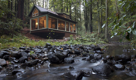
HOUZZ TOURSHouzz Tour: A Creekside Cabin Opens to the Views
With a modern addition featuring expansive windows, a rustic 1930s cabin opens its arms wider to its Northern California woodland setting
Full Story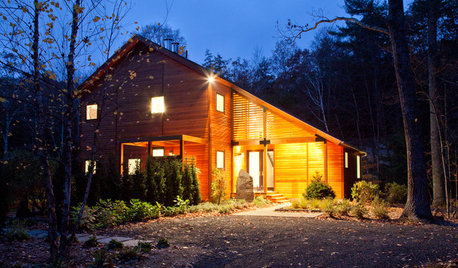
CONTEMPORARY HOMESHouzz Tour: Strong, Modern Lines Stand Up to the Trees
Modernism takes kindly to the New York woods, with double-height ceilings for openness and a burbling creek for music
Full Story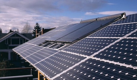
GREEN BUILDINGLet’s Clear Up Some Confusion About Solar Panels
Different panel types do different things. If you want solar energy for your home, get the basics here first
Full StoryMore Discussions


tropicalzone7
brooklyngreg
Related Professionals
Folsom Landscape Architects & Landscape Designers · Rossville Landscape Architects & Landscape Designers · Wilmington Landscape Contractors · Danvers Landscape Contractors · Golden Gate Landscape Contractors · Kaneohe Landscape Contractors · Lees Summit Landscape Contractors · Louisville Landscape Contractors · San Antonio Landscape Contractors · Waltham Landscape Contractors · Woodbury Landscape Contractors · Winter Gardens Landscape Contractors · Auburn Window Contractors · West Chester Window Contractors · Winnetka Window ContractorsLoveplants2 8b Virginia Beach, Virginia
jimhardy
NoVaPlantGuy_Z7b_8aOriginal Author
NoVaPlantGuy_Z7b_8aOriginal Author
Loveplants2 8b Virginia Beach, Virginia
jimhardy
NoVaPlantGuy_Z7b_8aOriginal Author
Loveplants2 8b Virginia Beach, Virginia
jimhardy
NoVaPlantGuy_Z7b_8aOriginal Author
jimhardy
tropicalzone7
beatrice_outdoors
NoVaPlantGuy_Z7b_8aOriginal Author
wetsuiter
NoVaPlantGuy_Z7b_8aOriginal Author
tropicalzone7
Loveplants2 8b Virginia Beach, Virginia
Hunter_M
NoVaPlantGuy_Z7b_8aOriginal Author
tropicalzone7
Hunter_M
tropicalzone7
NoVaPlantGuy_Z7b_8aOriginal Author
tropicalzone7
NoVaPlantGuy_Z7b_8aOriginal Author
NoVaPlantGuy_Z7b_8aOriginal Author
NoVaPlantGuy_Z7b_8aOriginal Author
NoVaPlantGuy_Z7b_8aOriginal Author
tropicalzone7
NoVaPlantGuy_Z7b_8aOriginal Author
NoVaPlantGuy_Z7b_8aOriginal Author
tropicalzone7
tropicalzone7
jimhardy
tropicalzone7
jimhardy
NoVaPlantGuy_Z7b_8aOriginal Author
Loveplants2 8b Virginia Beach, Virginia
jimhardy
tropicalzone7
wetsuiter
NoVaPlantGuy_Z7b_8aOriginal Author