

Attention weather hounds
david52 Zone 6
15 years ago
Sort by:Oldest
Comments (6)
Related Stories
DECORATING GUIDESAtten-TION! Win Design Battles With Military Decor
Rally the troops at your home base with World War II–inspired furniture and accessories
Full Story
EXTERIORSCurb Appeal Begs Your Attention
Attending to the details of your home's exterior will reap ample rewards in both allure and resale value
Full Story
WINTER GARDENINGHow to Help Your Trees Weather a Storm
Seeing trees safely through winter storms means choosing the right species, siting them carefully and paying attention during the tempests
Full Story
PETS50 Dog Photos Worth a Wag
Design hounds: Share in the pet love with Houzzers' snapshots of their beloved dogs at home, in the workshop and at play
Full Story
FLOORSHave Your Own Red Carpet Moment Anytime
Make every day feel like an event by rolling out a red carpet at home. Autograph hounds optional
Full Story
LIFE‘A Little Bold Color Goes a Long Way’ and Other Houzz Quotables
Home projects, advice and even a tour of a castle captured our attention this week
Full Story
DECORATING GUIDESSee How Wabi-Sabi Can Bring Harmony and Beauty to Your Home
Create your own wabi-style style with beautifully weathered, humble materials around the house
Full Story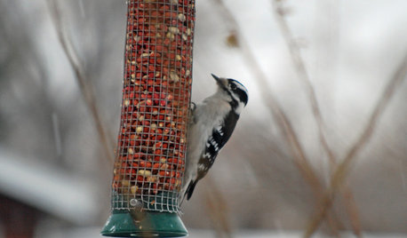
GARDENING GUIDESRocky Mountain Gardener's January Checklist
The weather outside may be frightful, but you can still maintain garden health and walkway safety
Full Story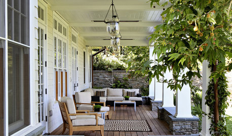
GARDENING AND LANDSCAPINGReaders' Choice: The 10 Most Popular Outdoor Spaces of 2012
All in the courtyard, please rise — these favorite patios, yards and decks deserve your full attention
Full Story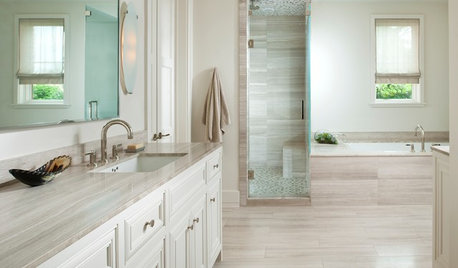
COLORBathed in Color: How to Get White Right in the Bath
Get the pure look you want without going institutional by paying attention to tone, texture and sheen in an all-white bathroom
Full StoryMore Discussions

greenbean08_gw
digit
Related Professionals
Accokeek Landscape Architects & Landscape Designers · Lyons Landscape Architects & Landscape Designers · Salem Landscape Architects & Landscape Designers · Springfield Landscape Contractors · Westwood Landscape Contractors · Garland Landscape Contractors · Hayden Landscape Contractors · Hilo Landscape Contractors · New Baltimore Landscape Contractors · Nutley Landscape Contractors · Rockland Landscape Contractors · Shirley Landscape Contractors · Winter Gardens Landscape Contractors · Selma Landscape Contractors · Moreno Valley Solar Energy Systemsbillie_ladybug
highalttransplant
Skybird - z5, Denver, Colorado
greenbean08_gw