


besides Ivan, how about Jeanne?
BarbC
19 years ago
Related Stories
ARCHITECTURE4 Things a Hurricane Teaches You About Good Design
When the power goes out, a home's design can be as important as packaged food and a hand-crank radio. See how from a firsthand account
Full Story
LIFEHow to Prepare for and Live With a Power Outage
When electricity loss puts food, water and heat in jeopardy, don't be in the dark about how to stay as safe and comfortable as possible
Full Story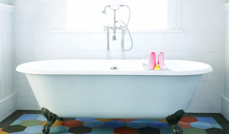
GREAT HOME PROJECTSHow to Get a Claw-Foot Tub for Your Bathroom
Here’s what to know about buying vintage or new — and how to refurbish a classic
Full Story
DECORATING GUIDES10 Ways to Give Your Hospitality a Tropical Touch
Treat guests to the resort treatment with blossoms, fruit and artwork that stir up an air of the exotic
Full Story
ARTShow News: Rare Quilts Get Museum Time
See 6 intricate designs from a California exhibition and get tips for building your own quilt collection
Full Story
STUDIOS AND WORKSHOPSCreative Houzz Users Share Their ‘She Sheds’
Much thought, creativity and love goes into creating small places of your own
Full Story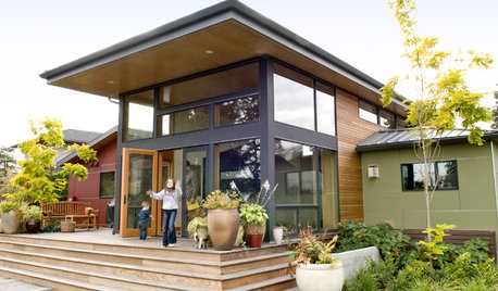
REMODELING GUIDESRoof Overhangs Project Lower Energy Costs
Make a dramatic style statement and lower home energy bills with a deep roof overhang on your house
Full Story
ORGANIZINGHelp for Whittling Down the Photo Pile
Consider these 6 points your personal pare-down assistant, making organizing your photo collection easier
Full Story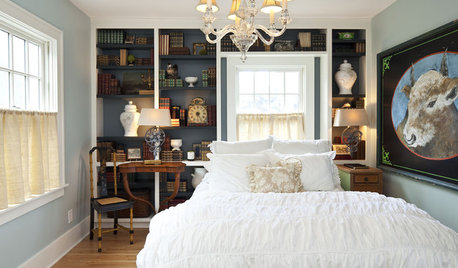
DECORATING GUIDESNovel Ways With Bedroom Books
Reading and relaxing go hand in hand. See how designers are incorporating mini and all-out libraries in the bedroom
Full Story
FURNITUREDecorating 101: How to Shop for Furniture
Learn what furniture to get rid of, what to look for when buying, and how to avoid mistakes
Full Story
wilmington_islander
CaseysMom
Related Professionals
Londonderry Landscape Architects & Landscape Designers · Ashburn Landscape Architects & Landscape Designers · Fitchburg Landscape Architects & Landscape Designers · River Forest Landscape Architects & Landscape Designers · Winder Landscape Architects & Landscape Designers · Del Aire Landscape Contractors · Downey Landscape Contractors · El Mirage Landscape Contractors · Hoffman Estates Landscape Contractors · Hollywood Landscape Contractors · Northport Landscape Contractors · Old Saybrook Landscape Contractors · Siloam Springs Landscape Contractors · Westchester Landscape Contractors · Lauderdale Lakes Landscape ContractorsDatawgal
dancingdachshunds
CaseysMom
shanklemsw
wilmington_islander
PeaBee4
BarbCOriginal Author
wilmington_islander
BarbCOriginal Author
PeaBee4
BarbCOriginal Author
shanklemsw
BarbCOriginal Author
BarbCOriginal Author
wilmington_islander
shanklemsw