


Zone changes??
songbirdmommy
17 years ago
Related Stories

HOME TECHHow Smart TV Will Change Your Living Room
Get ready for the future of TV, in which your living room becomes a movie set, a communication hub and a gaming zone
Full Story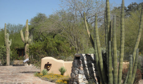
SOUTHWEST GARDENINGUnderstanding the American Southwest's Three Main Climate Zones
If you live in one of the arid or semiarid regions of the U.S. Southwest, this gardening zone guide is for you
Full Story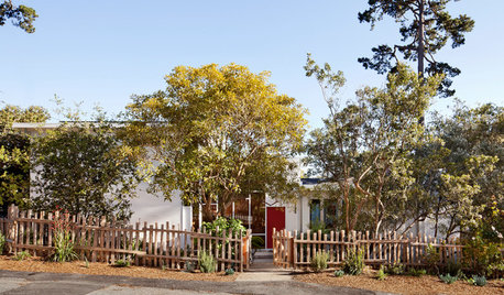
MIDCENTURY HOMESHouzz Tour: Small Changes Earn a Top Green Rating
Remodeling for energy efficiency and sustainability within a quaint town's codes wins LEED platinum certification for a midcentury home
Full Story
DECORATING GUIDES10 Ways to Tiptoe Out of Your Decorating Comfort Zone
Ease into waking up your space with small doses of decorating daring that express who you are right now
Full Story
MOST POPULARKitchen Evolution: Work Zones Replace the Triangle
Want maximum efficiency in your kitchen? Consider forgoing the old-fashioned triangle in favor of task-specific zones
Full Story
COLORTime to Step Out of Your Color Comfort Zone?
If you always seem to pick warm tones, or you stick to the cool ones, bucking your natural inclination could bring new energy to a room
Full Story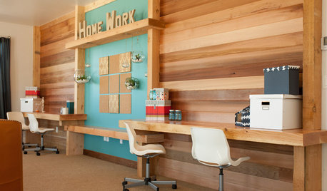
KIDS’ SPACES5 Ideas for a Great Home Learning Zone
Get your child off to a good start this school year with homework areas and strategies that reduce the frenzy
Full Story
KITCHEN WORKBOOKNew Ways to Plan Your Kitchen’s Work Zones
The classic work triangle of range, fridge and sink is the best layout for kitchens, right? Not necessarily
Full Story
THE HARDWORKING HOMEA New Drop Zone Keeps the Clutter at Bay
The Hardworking Home: A clever wall-mounted station for keys, phones and more helps a family stay organized
Full Story
GARDENING AND LANDSCAPING10 Great Outdoor Chill Zones
Whether you have a huge poolside deck or a sliver of a patio, these ideas will kick stress to the curb all summer long
Full Story
stevation
sangsara
Related Professionals
Wrentham Landscape Architects & Landscape Designers · Havre de Grace Landscape Architects & Landscape Designers · Salisbury Landscape Architects & Landscape Designers · Dinuba Landscape Contractors · Harvey Landscape Contractors · Pahrump Landscape Contractors · Seminole Landscape Contractors · Siloam Springs Landscape Contractors · South Portland Landscape Contractors · Tuscaloosa Landscape Contractors · West Haverstraw Landscape Contractors · Maple Heights Landscape Contractors · Marlton Siding & Exteriors · New Britain Siding & Exteriors · Clearfield Siding & Exteriorssangsara
zone_denial